

The Deep Brief #36 | 11 April 2026
Your end-of-week ocean intelligence, built to inform, agitate, and equip you

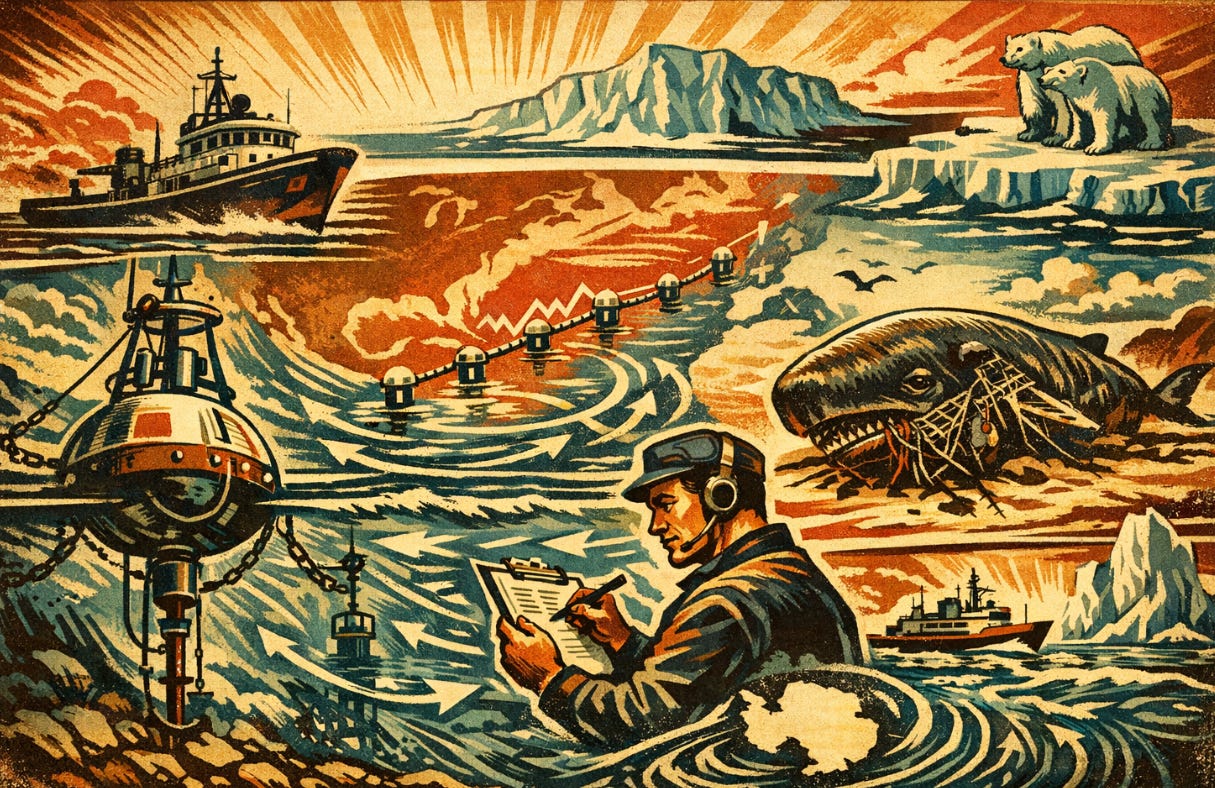
Stretched across the Atlantic at twenty-six and a half degrees north, running from the Bahamas toward the Canary Islands, a network of anchored instruments has spent the past two decades measuring how much water is moving through the ocean’s largest heat engine. They record temperature, salinity, velocity and pressure to build a continuous picture of the current that keeps Europe warm. This week, scientists using that data published the strongest direct observational evidence yet that the engine is slowing down across four separate locations in the Atlantic basin.
That story sits alongside a study of four sperm whales that washed ashore in the southeastern United States with fishing gear in their stomachs and undersized squid in their guts, and research into how the planet’s most powerful ocean current, a flow carrying more than a hundred times the water of every river on Earth combined, first came into being. Three deep dives. Three quick hits. One hard truth from the sea.
Deep Dives
The Atlantic’s great heat engine is slowing. Scientists now have the strongest evidence yet.
The Atlantic Meridional Overturning Circulation, known as the AMOC (the word meridional just means running north to south), is a system of ocean currents that moves warm, salty water from the tropics north toward the Arctic, releases its heat into the atmosphere, and sends the cooled, denser water back south along the seafloor. It is the reason Western Europe has milder winters than parts of Canada at the same latitude, and it is part of the global conveyor belt that redistributes heat around the planet. Climate scientists have warned for years that it is slowing down, and that a complete collapse would reshape weather, rainfall, and sea levels across much of the Northern Hemisphere.
A new study led by Qianjiang Xing at the University of Miami, published this week in Science Advances, now provides what the German oceanographer Stefan Rahmstorf, who was not involved in the work, called the strongest direct observational evidence so far that the AMOC is weakening.
The researchers drew on data from RAPID-MOCHA, a network of anchored instruments that has monitored the Atlantic since 2004. The array stretches across the ocean at roughly 26.5 degrees north. It measures temperature, salinity, and water velocity, which together allow scientists to estimate pressure on either side of the basin. Pressure differences matter because water flows from high pressure to low pressure, the same way air moves from a pumped-up tyre when you open the valve, so changes in pressure across the ocean are a direct fingerprint of how much water is moving. The team examined pressure data from three additional mooring arrays installed since 2004 along the western side of the Atlantic, the side closest to North America, off the West Indies, the US East Coast, and Nova Scotia. Across all four locations, the signal was consistent: the circulation is weakening, and the weakening is real, not an artefact of one mooring or one latitude.
The measured decline, based on RAPID-MOCHA data alone, amounts to roughly 10 per cent between 2004 and 2023. The margin of error on that figure is almost as large as the figure itself, which is why the pressure analysis matters. When Xing’s team looked at pressure data from the other three arrays, the weakening became clearer and the uncertainty dropped. The signal that started along the western side of the basin was propagating across the wider Atlantic.
There is a complication to flag. In 2024, a separate team led by Denis Volkov at NOAA published findings showing that the Florida Current, which forms the beginning of the Gulf Stream and is itself a key component of the AMOC, has remained remarkably stable over forty years of observations. Volkov’s team noted that their finding did not refute a broader AMOC slowdown. The AMOC is not one current but a system with multiple branches that can behave differently at different depths and latitudes, which means Xing’s study does not contradict Volkov’s so much as suggest that the weakening is showing up in parts of the system that Volkov’s instruments do not monitor.
The underlying mechanism that scientists worry about is simple in outline. As the Greenland ice sheet melts, fresh water pours into the North Atlantic, and fresh water is less dense than salty water. Less dense water does not sink as readily, which means the cooled water at the northern end of the conveyor belt struggles to descend and complete the loop. If the loop slows enough, it can reach what physicists call a tipping point, beyond which the entire system reorganises into a weaker state. Climate models have predicted this for decades, and the instruments in the water are now starting to see it.
The consequences of a significant AMOC slowdown, according to climate modelling, would include colder winters across Northern Europe, disruption to the monsoon rains that sustain agriculture across parts of Africa and Asia, and a pronounced rise in sea levels along the US East Coast. None of these would happen overnight, and a collapse, if it came, would unfold over decades. What Xing’s study adds is observational evidence that the process which might lead to one has already begun.
In January 2026, Iceland formally classified a potential AMOC collapse as a national security risk. Other countries have not yet followed.
Four sperm whales washed ashore with empty stomachs and pockets full of fishing gear.
Between 2020 and 2022, four sperm whales stranded separately on the beaches of Florida and Alabama. Each was alive when found, and each died shortly afterwards. Because they were alive at the time of stranding, researchers were able to conduct full post-mortem examinations, which is rare. Most stranded whales have decomposed by the time anyone reaches them, destroying the tissue evidence that might explain what killed them.
The four whales were examined by a team led by Jennifer Bloodgood, now at Cornell University, along with collaborators at the Dauphin Island Sea Lab and the Harbor Branch Oceanographic Institute. Their findings, published 9 April in the journal Diseases of Aquatic Organisms, describe a consistent pattern across all four animals: emaciation, malnutrition, and in two of the whales, large quantities of ingested fishing gear. One had a length of longline gear, the kind used for commercial deep-sea fishing, with a minimum of 480 branch lines, wrapped around its lower jaw, with a wad of trawl net in its throat and more gear in its stomach. Another had sections of gill net, trawl net and longline gear in its stomach.
The stomach contents also revealed something subtler. The whales had been eating their normal prey, mostly squid, in quantities that should have been enough to sustain them. Two contained well over 1,000 squid beaks, which is how researchers identify what a whale has been eating after the soft body parts have been digested. The beaks allow scientists to estimate the size of the squid the whale was consuming. The beaks in these whales were, on average, smaller than expected. The whales were eating squid, but they were eating smaller, less nutritious squid than sperm whales normally eat.
This matters because a sperm whale that has to eat smaller squid to stay fed has to dive more often and work harder for the same amount of energy. Sperm whales hunt by echolocation, the use of internal sonar to find prey in total darkness. Human activities that produce underwater noise, including seismic surveys for oil and gas exploration in the Gulf of Mexico and the movement of commercial shipping, can disrupt that sonar. The study cannot prove that any specific whale’s death was caused by any specific noise source. What it can do is identify a pattern: emaciated whales, derelict fishing gear in their bodies, a documented trend toward smaller prey, and an environment in which the tools they use to find food are increasingly contaminated by human sound.
“Many of the issues come back to potential human influences,” Bloodgood said in a statement released by Cornell. “We’re the ones causing many of these issues and many of them should be entirely preventable.”
Sperm whales are listed as endangered under the US Endangered Species Act. They were hunted close to extinction in the 19th and 20th centuries, primarily for the waxy oil in their heads, which was used in candles and lubricants. Commercial whaling for sperm whales ended in 1987, and the species has been recovering slowly ever since. The four whales in this study died of something else entirely.
The planet’s most powerful ocean current carries more water than every river combined. Scientists have now worked out how it was born.
The Antarctic Circumpolar Current runs clockwise around Antarctica, uninterrupted by any landmass, carrying more than a hundred times the water that flows in every river on Earth combined. It isolates the southern continent thermally, which is the reason Antarctica has been able to build and hold its enormous ice sheet. It draws down carbon dioxide from the atmosphere. It is, along with the AMOC, one of the two largest circulation systems in the global ocean, and it shapes climate everywhere.
For decades, scientists assumed the current formed when tectonic plates pulled South America and Australia away from Antarctica around 34 million years ago, opening the Drake Passage and the Tasman Gateway and allowing water to flow freely around the pole. That was the moment, the standard explanation held, that the current came into being and the planet began its long slide from a warm world with little permanent ice into the colder state we live in now, with permanent ice caps at both poles. It is a transition climate scientists call the move from a greenhouse to an icehouse climate.
A new study published in the Proceedings of the National Academy of Sciences by a team led by Hanna Knahl at the Alfred Wegener Institute in Germany suggests the standard explanation is incomplete. The opening of the sea gateways was necessary, but on its own, it was not enough to ignite the current.
Knahl and her colleagues ran detailed climate simulations using the geography of the Earth as it was roughly 33.5 million years ago, when Australia and South America were much closer to Antarctica than they are today. They coupled those simulations to a model of the early Antarctic ice sheet developed in a 2024 study. The results showed that even after the sea gateways had widened, the circumpolar current remained weak and incomplete, with strong flow developing in the Atlantic and Indian sectors while the Pacific sector stayed largely stagnant. The planet’s dominant ocean current had not yet come into being.
What eventually ignited it, according to the study, was wind. As Australia continued to drift north, the Tasman Gateway, the sea passage between Antarctica and Australia, eventually lined up with the band of westerly winds that still roar across the Southern Ocean today. Once those winds could blow directly through the gateway without obstruction, they drove the current into its modern, continuous loop, completing the ring around Antarctica. The continent’s thermal isolation deepened, carbon dioxide drawdown accelerated, and the planet cooled into the icehouse state that still defines the present climate system.
The atmospheric CO2 concentration at the time the current was forming was around 600 parts per million. That level has not been reached in the 34 million years since. Current concentrations are around 425 parts per million and rising. Under some projected emissions pathways, the 600 ppm figure could be exceeded before the end of this century.
Knahl urges caution about drawing direct parallels. “The climate of the past can of course not be projected one to one onto the future,” she said in a statement released with the study. The circumpolar current in its infancy, her team found, behaved differently from the mature current that exists today. What the study does make clear is that ocean circulation systems that feel permanent, that have shaped life on the planet for millions of years, depend on configurations of geography, wind, and temperature that are not guaranteed.
Quick Hits
A sleeper shark has been filmed in Antarctic waters for the first time. In January 2025, a camera deployed by the Minderoo-UWA Deep-Sea Research Centre captured footage of a southern sleeper shark cruising at around 500 metres depth off the South Shetland Islands, north of the Antarctic Peninsula. The water temperature was close to freezing. The footage, released in February and circulating again this week, was the first time any shark has been documented this far south. “There’s a general rule of thumb that you don’t get sharks in Antarctica,” said Alan Jamieson, the founding director of the research centre. “And it’s not even a little one either. It’s a hunk of a shark.” The specimen was estimated at between three and four metres in length. Scientists caution against immediately attributing the sighting to climate change. Antarctic waters are among the least studied on Earth, and research cameras operate only during the Southern Hemisphere summer, meaning that for roughly three quarters of the year, nobody is looking at all. The sharks may have been there all along.
An underwater mountain 4,200 metres tall has been mapped north of Palau. In September 2025, NOAA Ship Okeanos Explorer, working as part of the agency’s Beyond the Blue: Illuminating the Pacific campaign, used multibeam sonar to map a seamount roughly 250 miles north of Palau. The feature rises from the deep ocean floor at around 4,400 metres depth to a summit just 243 metres below the ocean surface, making it about half the height of Mount Everest. The seamount had been hinted at in nautical charts published in 2023, but the NOAA survey provided the first high-resolution picture of its shape. Scientists estimate there are more than 100,000 large seamounts on Earth. Less than one tenth of one per cent have been explored. Each one that gets mapped becomes a potential target for biological surveys, because seamounts tend to host dense concentrations of corals, sponges, and fish attracted to the hard substrate and accelerated currents their shapes create.
New Zealand is surrounded by some of the most energetic water on the planet. Tapping it is harder than it looks. Writing for The Conversation and RNZ, physical oceanographer Craig Stevens, who holds a joint position at Earth Sciences New Zealand (formerly NIWA) and the University of Auckland, lays out the country’s marine energy potential and the reasons so little of it has been harnessed. The west coast is swept by waves generated across the Southern Ocean. Cook Strait, between the North and South Islands, is one of the most energetic stretches of tidal water anywhere. Tidal energy globally now accounts for nearly two thirds of the non-wind ocean energy market, and the UK and France are planning 400 megawatts of new tidal stream infrastructure over the next decade. New Zealand, despite the resource, has yet to complete a single tidal energy project. The reasons, Stevens argues, are familiar: high upfront costs, limited economies of scale, cautious investors, and a history of schemes that over-promised what the technology of the day could deliver. A proposed tidal scheme in Kaipara Harbour, north of Auckland, was once billed as capable of powering 250,000 homes. It was never built.
Hard Truth From The Sea
Every ocean system in this week’s brief took millions of years to come into being. The currents that isolate Antarctica and warm Europe assembled themselves slowly, through the drift of continents and the alignment of winds, into states that have shaped life on the planet ever since. Sperm whales evolved into the deep-diving hunters they are today over a similar span of time, refining the sonar they use to find food in total darkness. Humans have managed, in roughly two centuries of industrial activity, to put measurable strain on all three. The relevant question is no longer whether we are changing the ocean. It is whether anyone with the power to act will move before the systems we depend on quietly stop working the way they always have.
Paid subscribers fund the reporting that tracks what is changing in the ocean and why. If you want accountability journalism on the systems we depend on and the institutions responsible for protecting them.
See you next week.
- Luke
The Sperm Whale piece is heart breaking Luke, the AMOC potential slow down terrifying. There are still large knowledge gaps in healthcare professionals which although understandable needs correcting. I want all those in healthcare to understand planetary boundaries, Keeling Curves and tipping points like the AMOC. We can then recruit them to use their trusted voices to communicate further and inspire actions which may help us survive.
Another great in-depth explanation about what’s happening to the AMOC and the serious climate impacts that will result. Whilst the impacts of the slowing AMOC are expected to occur over a very long time period, the question arises as to the probability that process may speed up significantly?